Weekend Sale is Live.
Get in touch @ +1234567890

Cart

13

Cart

Quantity
5,00 
Quantity
5,00 
Quantity
4,00 
Quantity
12,00 
Quantity
18,00 
Quantity
4,00 
Quantity
5,00 
Quantity
4,00 
Quantity
5,00 
Quantity
5,00 
Quantity
18,90 
Quantity
4,00 

    Cart

    13

    Cart

    Quantity
    5,00 
    Quantity
    5,00 
    Quantity
    4,00 
    Quantity
    12,00 
    Quantity
    18,00 
    Quantity
    4,00 
    Quantity
    5,00 
    Quantity
    4,00 
    Quantity
    5,00 
    Quantity
    5,00 
    Quantity
    18,90 
    Quantity
    4,00 

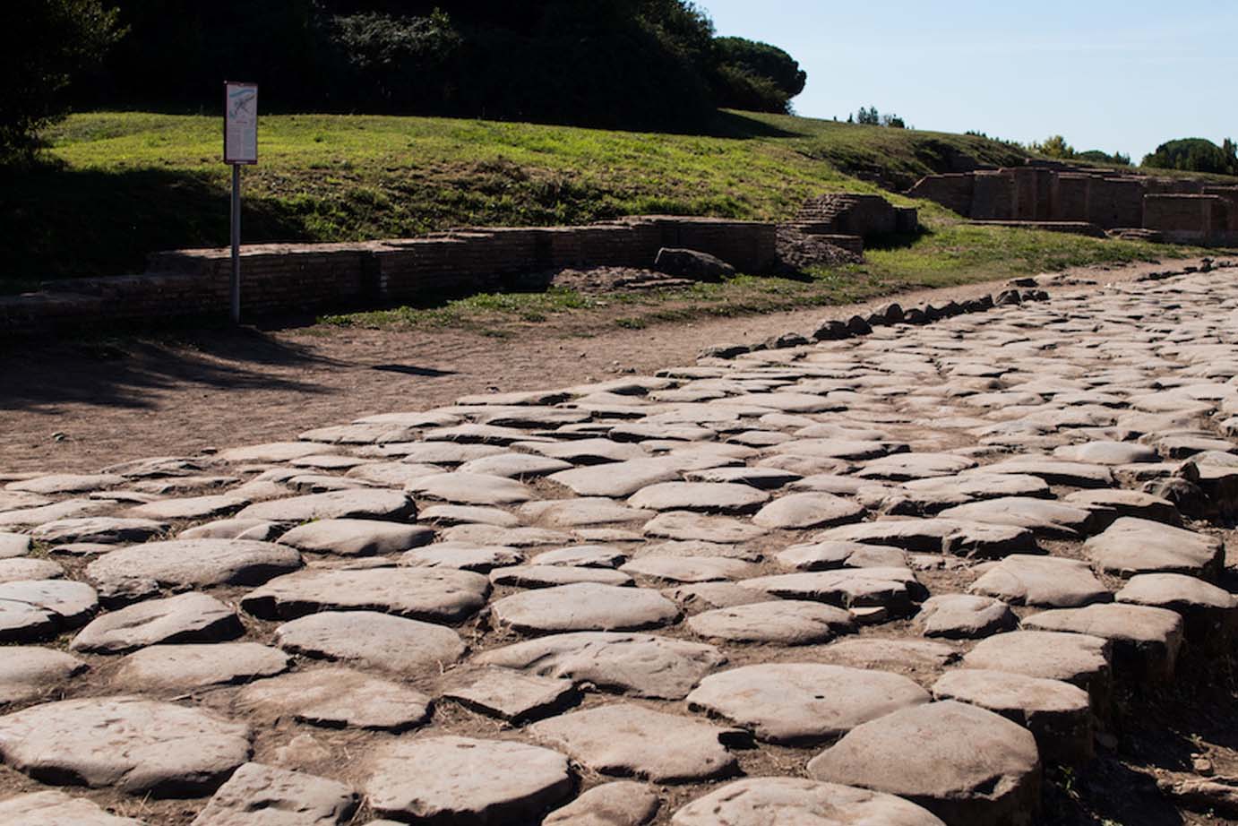
      The Roman Roads of Puglia

      fty

      The Romans followed the pre-existing Iapygian road network. In fact, the Iapygian, Daunian, Peucetian and Messapian populations had already established a fairly widespread road network. However, the Romans strengthened its organization. The maintenance of the vast and complex road system was the responsibility of the curatores (superintendents of the roads), the subcuratores (under-curators) and their assistants. The costs for construction and maintenance, however, were borne by the treasury. During times of peace, most of the labor employed in building a road consisted of professional soldiers; the remainder was hired by the municipalities. Along the roads there were itinerary stations called mutationes and mansiones, intermediate stops that allowed travelers to refresh themselves, spend the night and use the stables to rest or change their horses. The postal service, vital for the administration and military security of the empire, was based on the mutationes.

      The most complete study in this regard is the one offered by G. Uggeri in the volume “La viabilità romana nel Salento”, published in 1983. His research was also based on Greek and Latin historical sources, the most significant of which is that of Strabo (Greek historian and geographer who lived between the 1st century BC and the 1st century AD), who provides useful information relating to almost all the roads of the Salento peninsula, including the overall distances measured in stadia (a Greek unit of measurement corresponding to 185 metres) and those between its main inhabited centres. Other important ancient sources are the itineraria, that is, documents – written or painted – which contain indications regarding the distances in miles between successive stages and the relative travel days. The Tabula Peutingeriana, the most significant of the preserved itineraries, dates back to the mid-4th century AD. It is a parchment roll – consisting of a succession of 12 sheets – on which the Ecumene is represented (the ancient world as it was known at the time of its drafting), with detailed indications of all the roads, intermediate stations, toponyms and distances measured in miles. The Tabula Peutingeriana is the only itinerary that offers a complete picture of the road system of the Salento peninsula – represented on the VII parchment – ​​with the highlighting of the capita viarum by means of a conventional symbol (two buildings placed side by side): Brindisi, Ydrunte, Castra Minervae and Tarento. Furthermore, two sub-regions are distinguished on the itinerary: Calabria, along the Adriatic side, and that of the Sallentini on the Ionian side, according to the traditional nomenclature. The main roads, which in this phase characterize the road system of Salento, are the Appian Way, the Traiana, the Traiana ‘Calabra’ and the ‘Sallentina’. The Appian Way – built in 312 BC by the censor Appius Claudius Centemmanus – was the first censorial road in the history of Rome. The road originally connected Rome to Capua. In 272 BC it was extended to Benevento and, immediately after the conquest of Taranto, to the Ionian city. The rise of Brindisi and the gradual decline of Taranto led to the further development of the road network up to the Adriatic city, an operation that proved fundamental to the Romans for their victory in the bellum sallentinum (267-266 BC). The Appian Way became, for about three and a half centuries, the main axis of connection between Rome and the East, through the bridgehead represented by the port of Brindisi. The artery underwent significant changes only with Trajan, following the Dacian expeditions (101-106 AD) and in anticipation of the subsequent Eastern campaign. Its importance lasted well beyond the end of the ancient world, as it continued to fulfill the traditional function of isthmian connection between Taranto and Brindisi, even though the latter port had by then declined in favor of Otranto. The Via Traiana – proclaimed via publica in 109 AD – was commissioned by the emperor Trajan to connect, more quickly, the capital of the empire with the important port of Brindisi. The road – therefore – represented an alternative route to the Via Appia, from which it branched off near Benevento. The name of Via Traiana ‘Calabra’, which does not appear in any ancient document and is used by scholars to indicate the stretch of road that connected Brindisi to Otranto, derives from the fact that it represented the ideal continuation of the Via Traiana – south of Brindisi – through the sub-region that the ancients called Calabria. The Via Traiana ‘Calabra’ acquired importance with the rise of the port of Otranto, the final destination of the Appian and Trajan roads. Lupiae (Lecce), as is evident from all the itineraries, was located halfway and served the function of mansio. Valesio represented an intermediate mutatio in the Brindisi-Lupiae stretch, while the mutatio ad XII was the intermediate stop between Lupiae-Otranto. During the Greco-Gothic war, the Via Traiana ‘Calabra’ assumed a fundamental role in military movements to and from Otranto. With the conventional term of via ‘Sallentina’ – in the absence of ancient sources – scholars have indicated the longest itinerary that crossed the peninsula of the same name in ancient times. It was a paralitoranal road that from Taranto reached Otranto passing through Vereto, a short distance from Capo Iapigio. This road was the natural extension of the Via Appia. It was mistakenly considered, instead, a continuation of the Via Traiana, and therefore this name has always been attributed to it. There is – in fact – no direct contact between the two arteries, being joined by the Via Traiana ‘Calabra’. The peak of its importance, however, was reached in the Messapian age, while in the Roman age the via ‘Sallentina’ represented a route of exclusively local interest, cut

      Leave a comment

      Your email address will not be published. Required fields are marked *

      Cart

      13

      Cart

      Quantity
      5,00 
      Quantity
      5,00 
      Quantity
      4,00 
      Quantity
      12,00 
      Quantity
      18,00 
      Quantity
      4,00 
      Quantity
      5,00 
      Quantity
      4,00 
      Quantity
      5,00 
      Quantity
      5,00 
      Quantity
      18,90 
      Quantity
      4,00 

        You have not viewed any product yet!

        Back To Shop